Work Improves a Unique Fishery in the Sandhills
Enlarge
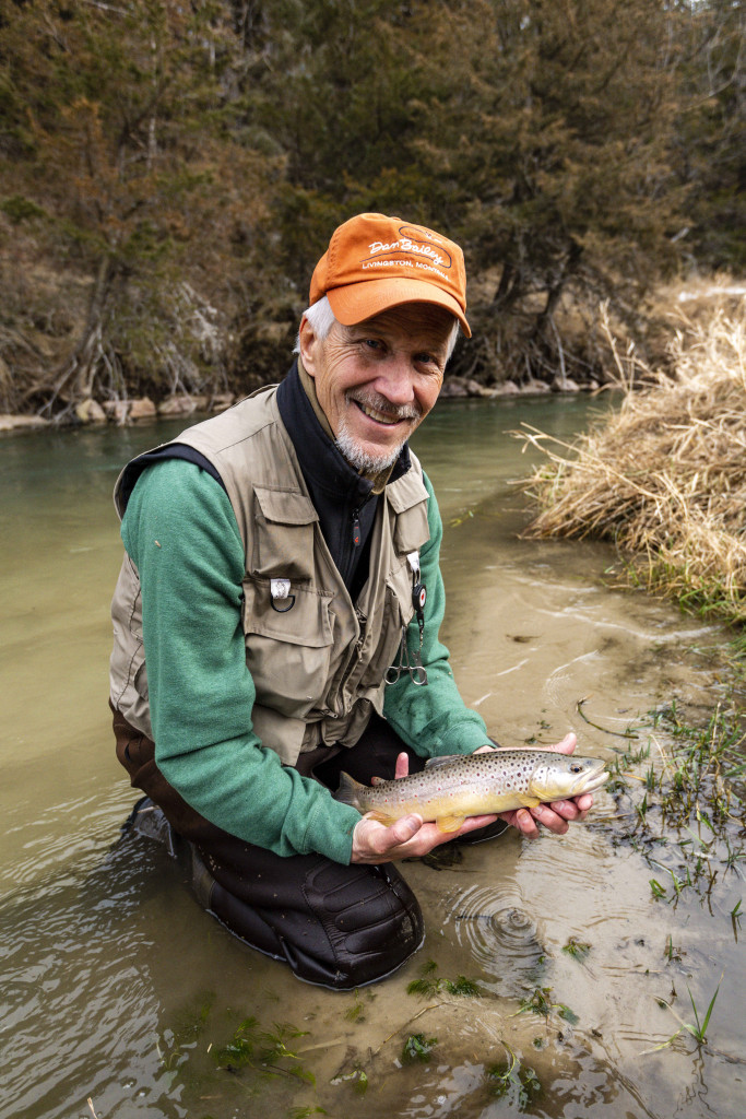
Photo by Eric Fowler, Nebraskaland
Story and photos by Eric Fowler
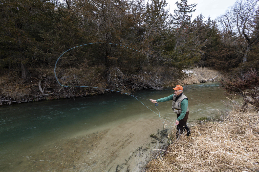
Joel Klammer repeatedly casts a woolly bugger fly toward rock structures in Long Pine Creek and lets it drift through the deep holes below them. He thinks he sees a fish attempting to bite on one drift, but after 20 minutes, he decides his first choice of flies wasn’t going to cut it on this section of the creek on Pine Glen Wildlife Management Area. So, he reaches into his fly box and ties on a big, brown, rubber-legged nymph.
“The water was moving pretty fast. I wanted something bigger to attract their attention,” Klammer said. “Those fish have to make a decision quick in that faster water. It’s floating by pretty quick. It’s no spring creek, where you’re floating your fly down the surface gently for a minute.”
It was another 20 minutes before that decision paid off, and he landed a brown trout that topped 10 inches. Forty minutes and a quarter mile upstream later, he landed his fourth brown, this one topping 12 inches.
The one thing each of the fish had in common, other than the fly they were caught on, is all were hooked near rock structures installed in the creek in 2019 as part of a Nebraska Game and Parks Commission Aquatic Habitat Program project designed to improve habitat for fish and success for anglers.
As the Stream Flows
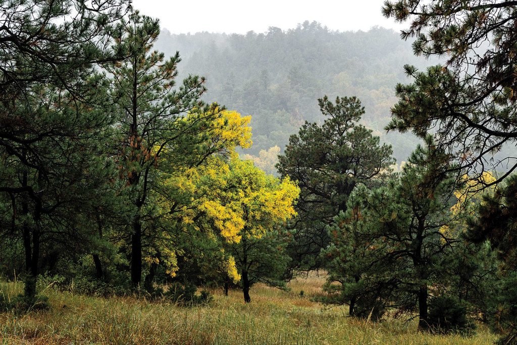
Long Pine Creek begins flowing in a pasture on the edge of the Sandhills southwest of the town of Long Pine. After flowing east for about 6 miles, it turns north, continuing roughly 20 miles, as the crow flies, until it meets the Niobrara River. Its winding path stretches 33½ miles, coursing through a canyon more than a mile wide and 200 feet deep in spots, which is forested with ponderosa pines, eastern red cedars and oaks — a stark contrast to the open range and cropland surrounding the canyon.
Along the way, the creek winds its way past cabins in Hidden Paradise Resort, where the cool, pristine waters have drawn vacationers since 1910. It continues through Long Pine State Recreation Area, a popular spot for people to camp, fish and drift down the stream in tubes to cool off on a hot summer day. After flowing beneath U.S. Highway 20, it crosses Long Pine Wildlife Management Area, and 13 stream miles later, Pine Glen WMA, both rugged areas that draw anglers and hunters.
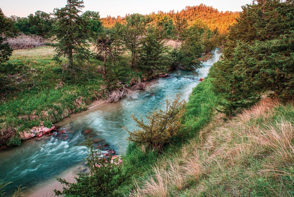
Similar to most of the streams that feed into the Niobrara River, Long Pine Creek’s base flow comes from springs of the Ogallala Aquifer. The creek is considered a Class A coldwater stream, where temperatures never top 77 degrees, making it cold enough to support trout even in the heat of summer. It runs clear, other than when rainfall washes in sediment. It is full of oxygen, supporting the mayflies, caddis flies and other aquatic life, and contains gravel beds on which trout can spawn: the same features you might find in a trout stream in Colorado. As such, it is one of the top trout waters in the state, with self-sustaining populations of both rainbow and brown trout.
The creek’s value for fish, wildlife and recreation are why it was the first water in Nebraska to gain an instream flow right from the state’s Department of Natural Resources. Granted to the Commission in 1989, the right helps ensure flows will be sufficient to sustain trout year round.
Growing Bigger Fish
Long Pine Creek flows lazily through Long Pine SRA. In the mid-1990s, the Commission installed wood lunker structures in the stream there to both create bank line habitat and prevent erosion. Aside from occasional maintenance, the structures have stood the test of time. Biologists sample more fish, both stocked and wild rainbow trout and wild brown trout, in that reach of stream than all but one other in the state.
By the time the stream reaches Pine Glen WMA, it has gained flows and velocity, and there is less in-stream habitat to hold fish. Fisheries biologists saw an opportunity to use the Aquatic Habitat Program to improve a reach of the stream there to benefit fish and anglers.
“We recognized that Pine Glen WMA was a good candidate because it’s somewhat secluded and with less harvest, it might allow us to grow some bigger fish with some additional habitat structures,” said Brett Roberg, a Commission stream biologist.
The work was modeled after another project completed on Nine Mile Creek in Scotts Bluff County, which boasts the highest density of trout in the state. When work similar to that was also done on a private stretch of the creek upstream from Pine Glen, “the trout literally moved into those habitat features almost immediately after we built them,” Roberg said.
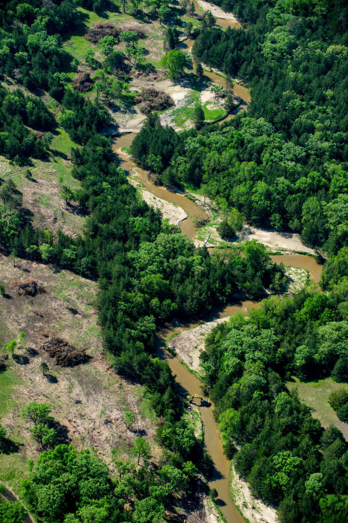
The in-stream habitat work focused on two straight runs that, combined, covered 1,800 feet and offered little variation in depth and habitat types.
An excavator was used to place boulders in and along the stream, creating nine different types of structures, 38 in all. The largest were cross-vane weirs, V-shaped structures pointing upstream with a notch at the tip, and weirs running straight across the stream, also with a notch. Both concentrated the flows through the notch, scouring holes below them.
Other structures included rock J-hooks and log formations that deflected flows away from the bank to reduce erosion, forcing the stream to meander more, and boulder clusters in the middle of the stream.
Combined, the structures were designed to create current breaks and a diverse range of velocities and depths, creating resting and feeding areas for trout and other native fish species. There are now more pools with deeper, slower moving water and riffles with shallow, swift flows.
Pools can provide the refuge fish need during low flows in the heat of the summer and are often where fish prefer to be in the cold of winter.
“They also make great places for trout to eat,” said Thad Huenemann, rivers and streams program manager with Game and Parks. “Think of the bugs that are floating through the system. Once you get to a pool, they sit there a little bit, and it provides an opportunity for trout to be able to munch down on a buffet of critters that are flowing through the system. And it allows them to rest because they don’t have to fight the current so much.”
The boulder clusters in the riffles serve a similar purpose, providing refuge from the current where trout can wait to ambush food in what Roberg said can be “the food factory of those systems more times than not.”
Increasing the meandering or sinuosity of the stream further diversifies the habitats. Each type of habitat supports different types of invertebrates, the aquatic insects trout live on, at different times of the year.
More Room to Cast
Before work could begin in the stream at Pine Glen, a path needed to be cleared to allow the heavy equipment to get there. The project began by clearing cedar trees from 26 acres of pine forest above the creek and in oak woodlands on the creekbottom. Some cedars were present here when the Commission acquired the 960-acre area in 1973, but the opportunistic invaders had since filled nearly every opening they could find in the canyon, and simply getting to the creek to fish was a challenge.
“It was rough,” said Roberg.
The clearing also gave anglers more room to cast, and made it easier for them to get from one spot to another.
Opening the forest on the floodplain also helped lessen the damage that may have occurred during two historic floods in 2019 that occurred before and after the project was completed: one came in March, when heavy rain fell on deep snowpack, and the second was the result of torrential rains in September. A gauge located downstream, below where Bone Creek joins Long Pine Creek, measured flows near and above 6,000 cubic feet per second where they are normally under 200 cfs. Elsewhere along the creek, the flooding caused severe erosion, uprooted trees and piled them along the banks, causing more erosion.
“[The floodwaters] moved into the area that had been full of cedar trees, so it actually, more than likely, protected some of our structures because it dissipated that energy over a bigger area,” Roberg said.
And where there were only cedars growing beneath the oaks on the floodplain, there are now numerous plant species, which has benefitted wildlife.
“The herbaceous community responded big time,” said Kelly Corman, a wildlife biologist who manages the area. “We had coveys of quail down in there the first couple of years after clearing, which was pretty neat to see. It’s certainly being utilized by deer quite a bit. And we’re seeing some young oak trees, some seedlings. It’s a good thing.”
An Evolving Stream
So far, the results in the stream aren’t exactly what biologists had hoped for. Three electrofishing surveys of the stream since work was completed have actually found far fewer trout than surveys conducted prior to the project. But biologists believe there are reasons for the discrepancy and that things will improve.
Flows in Long Pine Creek have, for the most part, been above normal since 2018, even during the severe drought in 2022. Those conditions make it much more difficult to sample trout, which during normal or below normal flows can be concentrated in a few holes and easy to catch.
So, it is likely there are more fish in this reach than biologists are able to sample. It is also possible that, while trout populations are fine upstream at Long Pine SRA, many were flushed out of the lower reaches of the stream where flows were the highest. That is what occurred in some sections of the Big Thompson River in Colorado during flooding in 2014. In one reach, the trout population declined by 85 percent. Roberg said biologists there have told him that fishery has since recovered, and it may take time for Long Pine Creek to do the same.
Huenemann said biologists who work on stream enhancement projects in other states have told him that while some work produces instant results, which is what managers and anglers hope for, sometimes it takes years and multiple generations of fish to establish a thriving population.
Additionally, the stream is still evolving. “We went in there and disrupted things, and the system is still trying to balance out,” said Huenemann.
Measurements taken when the project was completed and the two years that followed found the depth to be increasing and the velocity decreasing in the pools below the new structures. Those changes are expected to stabilize.
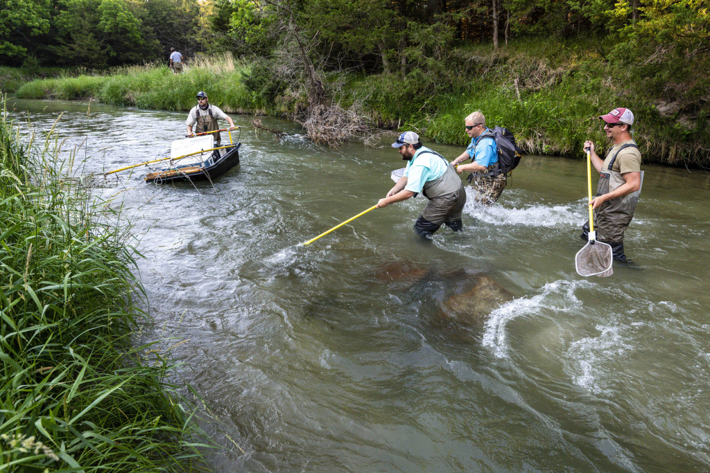
use an electrofishing barge to sample fish in Long Pine Creek. Photo by Eric Fowler, Nebraskaland.
With no breaks in the current prior to the project, there was no water buttercup, elodea or other aquatic vegetation growing in this reach of the stream that is common upstream. Those plants, however, are now starting to grow in the sediments that have been deposited in the slack water areas above and below the structures.
“Once you have that vegetation established, it creates cover for fish,” Huenemann said. “That’s what you’re hoping to promote. Prey species occupy those areas, and you’re promoting macroinvertebrate growth and future food sources for trout.”
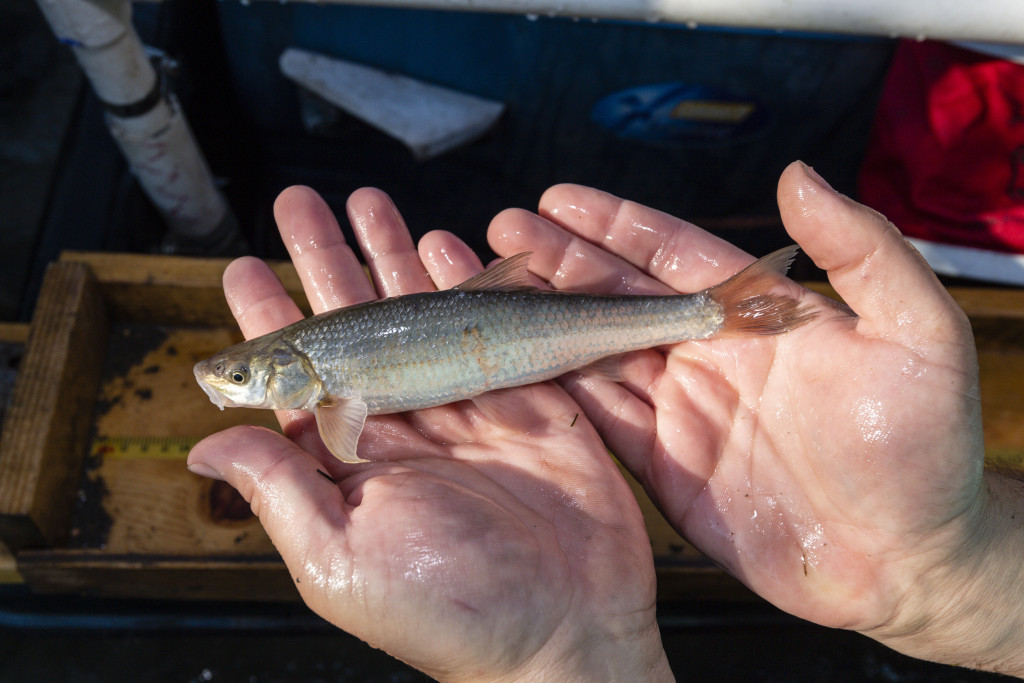
Sampling has shown that the diversity of species in the creek at Pine Glen has increased. Aside from the brown and rainbow trout, pre-project sampling found only two other species: longnose dace and white suckers. Post sampling found eight additional species, including the flathead chub, a species of concern in Nebraska. A warmwater species native to the Missouri River Basin but in serious decline, it is common in Long Pine Creek between the mouth of Bone Creek and the Niobrara, a reach not considered a coldwater stream. The species is likely moving upstream during summer.
As was the case prior to the project, the trout that are sampled are primarily browns, but both browns and rainbows are larger than in upstream reaches, up to 15 and 14 inches, respectively. “One of the things we’ve noticed on some of the other tributaries is the brown trout are the ones that seem to be the most dominant in the lower sections of those watersheds,” Roberg said. “Brown trout are a little more adaptable to higher turbidity and slightly warmer temperatures. But often do best in cool, clean water.”
Eventually, more trout will find the habitat created by these new structures, be it wild browns or rainbows stocked at the SRA.
“I think once we get a population in there that kind of stays, there’s enough habitat to fulfill their life cycles in those areas,” Huenemann said. “So, theoretically, we can start seeing opportunities for spawning and reproduction and a sustainable population down there.”
A Bright Future
Klammer, a former fisheries biologist for the Commission, had spent time working and fishing on the creek prior to the Aquatic Habitat Project. Looking at the work from both aspects, he liked what he saw.
“It created some deeper water, nice holes, holding areas, slack water … that’s what fish are looking for,” he said. “I thought those structures added some nice habitat and some good places for fish to hold, and obviously there were some holding there that day.
“That was a really good day for December fly fishing.”
A Hike Worth the Effort
To fish Pine Glen Wildlife Management Area, pack your hiking waders. While the Aquatic Habitat Program project there included building a two-track road, that road is not open to the public. It does, however, serve as a trail that anglers can follow to the creek, and the hike is worth it for those looking to escape the crowds and immerse themselves in a landscape few realize exists in Nebraska.
“Pine Glen provides more of what I call a rare opportunity to hike into a remote trout stream surrounded by oak woodlands in a deep pine canyon,” said Kelly Corman, the wildlife biologist who manages the area. “It’s an experience that you don’t necessarily get in Nebraska, and too many places. It’s kind of a unique quality. That would be lost if you could drive to the bottom, and it would change the character of the area.”
The hike in following the maintenance road, located on the north end of the wildlife management area, covers a little more than 700 yards and drops 230 feet. Some anglers follow a second, unimproved, unmarked trail that winds through the woods on the southern portion of the area and is 100 yards shorter with a similar elevation change.
Corman said two other areas on the creek, one of the best trout waters in the state, don’t require as much effort. At Long Pine State Recreation Area, one can almost drive to the stream bank. Across Highway 20, anglers can take an access road to the creek bottom and hike a primitive trail less than 300 yards to the creek on Long Pine Wildlife Management Area.
“I like the idea of having an area where if someone is willing to hike a little bit, they can maybe avoid some of the fishing pressure,” said Joel Klammer of Ainsworth, who mostly visits the stream in the fall when flows are lower. “There are other areas where you can drive within feet of the bank.
“I’ve always thought Pine Glen was a neat spot. It’s a long hike down there, but if you go, you’re probably going to have it to yourself.”
The post Long Pine Creek appeared first on Nebraskaland Magazine.


