
Game and Parks Still Working to Recover
Enlarge
By Eric Fowler
For many Nebraskans, 2019 was a tough year. Historic flooding in March sent nearly every river in the eastern half of the state out of its banks, washing out highways, bridges, dams, levees, farms and homes, and killing four people and countless livestock.
Flooding along the Missouri River in southeastern Nebraska continued throughout the year. More floods hit south-central Nebraska in July and the northeast in September. It is estimated that the flooding caused more than $3 billion in damage to infrastructure and property in Nebraska.
Publicly owned lands managed by the Nebraska Game and Parks Commission were not spared. Of the 76 state parks and recreation areas it oversees, 28 were damaged by flooding. So were 67 of the state’s 289 wildlife management areas, several segments of the Cowboy Recreation and Nature Trail, and numerous fisheries. The estimated cost to clean up and repair the damage adds up to nearly $19 million.
For some outdoor enthusiasts, the flooding meant looking for different places to camp, fish or hunt, as many areas were closed for extended periods, some the entire year. For Game and Parks, it meant $1.2 million in lost revenue from Park Entry Permit sales, campsite rentals and other activity fees.
The agency has worked to repair as much of the damage as possible, and has been formulating a plan to finish the work and return these resources to the condition that Nebraskans know and love. Paying for the repairs, however, remains a challenge for the agency, which is funded primarily by user fees. Those fees haven’t been able to keep up with the needs the agency has, not only for expansion of services, but also for maintenance of existing facilities. With help from the Nebraska Legislature in recent years, Game and Parks was beginning to make headway on a $76 million backlog in maintenance projects.
The Federal Emergency Management Agency will provide considerable assistance, covering 75 percent of the cost of eligible repairs. It is hoped the Legislature will provide assistance as well. Getting that money in hand takes time. And with a considerable share still falling on Game and Parks, it will likely put some construction and maintenance projects that had been planned on hold. But the work will be done, because the resources, and the enjoyment they provide Nebraskans and visitors to our state, are worthwhile investments.
“The damage was major, but we were fortunate. No staff or visitors were hurt,” said Jim Douglas, director of Game and Parks. “Our staff worked long hours in dangerous conditions to evacuate several communities, staff worked hard to put affected properties back together, and hundreds of volunteers turned out to help clean up debris. We moved quickly to repair roads and other infrastructure, and upgraded electrical pedestals at several campgrounds. Our staff responded with agility and ingenuity, while keeping an eye on the future.
“This response reinforced a few things that have long been evident to me: our staff cares deeply about the resources we manage, the public cherishes our state’s parks and other outdoor resources, and Nebraskans, by and large, value the Commission’s work.”
Parks
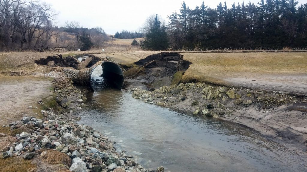
When rain began to fall on melting snow in early March, water that rushed into the frozen Niobrara River broke up ice that was up to two feet thick and sent it downstream. The pressure of the increased flows and ice proved more than Spencer Dam, built in 1927, could handle.
When the dam breached on March 14, it unleashed a 10 to 15 foot wall of ice and water. Below the dam, the Straw Bale Saloon and a campground were erased, and the saloon’s owner, Kenny Angel, killed. Spencer Dam WMA, an area managed by Game and Parks and popular among catfish anglers, was scoured by flows, and the Highway 281 bridge washed out. As it continued to the Missouri River, the ice and water wiped out more bridges, businesses, homes and farms. South of Verdel, a river gauge measured flows at 123,000 cubic feet per second where flows are normally 2,000 cfs.
One of those bridges was located about 35 miles downriver on
Highway 12 at Niobrara, where the river crested nearly 7 feet above previous record. Videos posted on social media of the 450-foot span of concrete and steel floating away on a river of ice illustrated the power of the flooding that was already happening, or soon would be, across eastern Nebraska.

A mile downriver, a historic steel railroad bridge that now served as a link on a popular trail running from Niobrara State Park to the village of Niobrara was swept away, as were other bridges and sections of trail. Due to repeated damage caused by flooding and the high cost, it is doubtful that the trail will be repaired.
With the highway closed, a commute between the park and town that took minutes now took hours, and the park struggled to find staff during the busy summer season. Damage to Highway 12 west of the park wasn’t repaired until May. With access difficult, fewer people visited the park and the village, and both lost business. When a temporary bridge was completed and the highway reopened in August, the town threw a party.
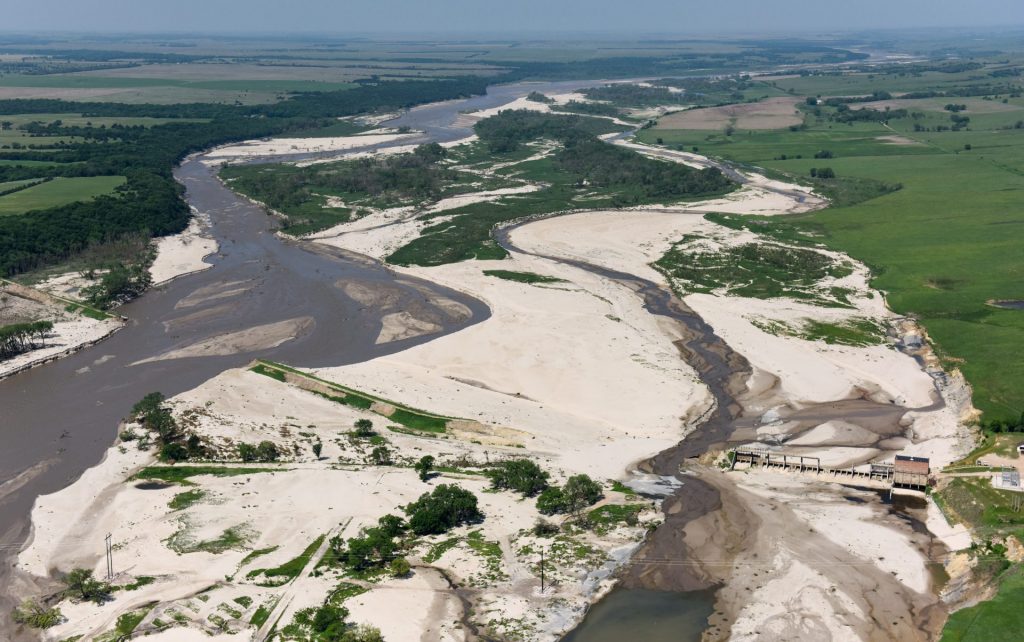
The Platte River crested at 4 feet above flood stage, an all-time record, on March 16 at Louisville. Fremont Lakes, Two Rivers and Louisville state recreation areas all sit on the banks of the Platte and were some of the most heavily damaged parks.
At all three parks, campsites were damaged by water, sand and ice, including Two Rivers, where ice sheared off electrical pedestals in the popular Cottonwood campground. Water rose high enough at Two Rivers to spill into the 10 Union Pacific caboose cabins, and roads were washed out both in the park and leading to it. At Fremont, several roads washed out, including the one leading to the Pathfinder Campground, forcing the construction of a new access road. Staff housing and shops were damaged at all three parks, as was the office at Louisville.
A new boat ramp and canoe and kayak launch at Louisville, part of the Commission’s Venture Parks initiative, was heavily damaged. New launches were also damaged upriver at Schramm Park SRA and Platte River State Park, as were railings and bridge supports on the Lied Bridge, another popular trail link. The bridge, owned by the Lower Platte South Natural Resource District and managed by Game and Parks, will remain closed until debris can be removed and damage fully assessed.
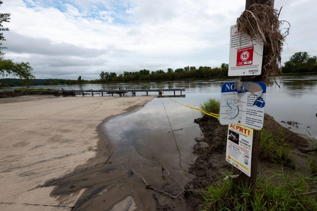
At Ponca State Park on the Missouri, flooding inundated the Riverfront campground and washed out a portion of the road circling it. It also turned backwaters on the park’s bottomland to flowing chutes, just as it did during the Missouri River flood in 2011, and damaged the boat ramp.
Flooding continued into November and December on the Missouri in southeastern Nebraska. At Nebraska City, Riverview Marina SRA, where the campground was damaged and four feet of silt had to be removed from the shower house, remains closed. At Indian Cave State Park, numerous mud slides damaged the boardwalk and covered the road to the cave. While the road was cleared and reopened in November, repairs to the boardwalk remain. The boat ramp remains closed.
The reservoir at Willow Creek SRA rose 10 feet, damaging most of the campsites, destroying two fishing piers, damaging several breakwaters and, on the reservoir’s upper end, a causeway that is part of a trail that circles the lake and links to nearby Pierce.
On the Elkhorn River, the bottomland portion of Dead Timber SRA was inundated, washing out the campground and the road to it, both of which reopened in late summer.
On the popular Elkhorn River Water Trail, three access points maintained by Papio-Missouri River NRD between Bennington and Omaha were damaged by flooding and closed much of the year.
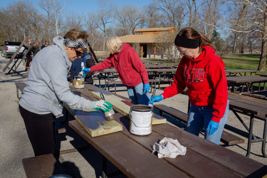
More than 300 volunteers helped Game and Parks staff on projects at several areas, including Louisville and Fremont, in the months after the flood, helping assure parks could reopen by Memorial Day.
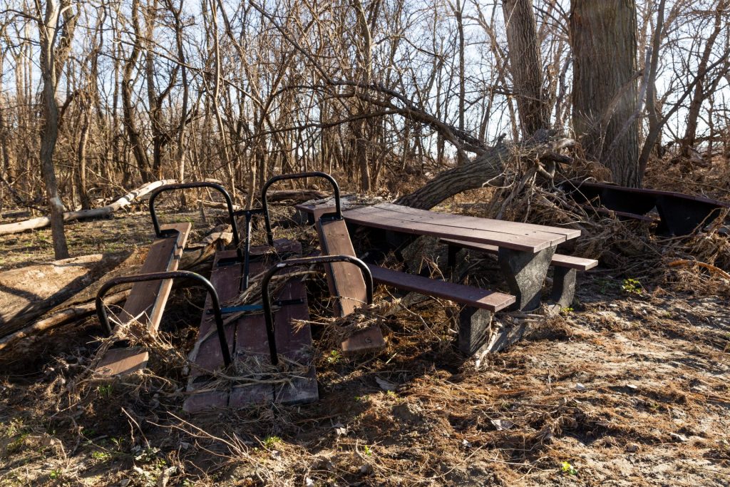
There is still much to be done. Picnic tables, pit toilets, fire rings and other campground amenities will have to be repaired or replaced. Where campgrounds were under water for extended periods, damage to electrical service was costly as numerous service panels and pedestals will need to be replaced. In all, repair costs to the parks are estimated at $7.7 million.
That doesn’t include damage to The Cowboy Recreation and Nature Trail that spans much of northern Nebraska and was complete from Valentine to Norfolk. It was damaged in 170 locations, forcing the closure of five segments of the trail. Near Valentine, a 100-year-old box culvert in an embankment is failing and causing the trail to collapse. East of Long Pine, another embankment washed out. Near Neligh, Oakdale and Norfolk, the Elkhorn River caused significant erosion on the embankment. Bridge approaches were damaged at O’Neill and Neligh. The estimated cost of repairs for damage to the trail in 2019 is $7.7 million.
Fisheries
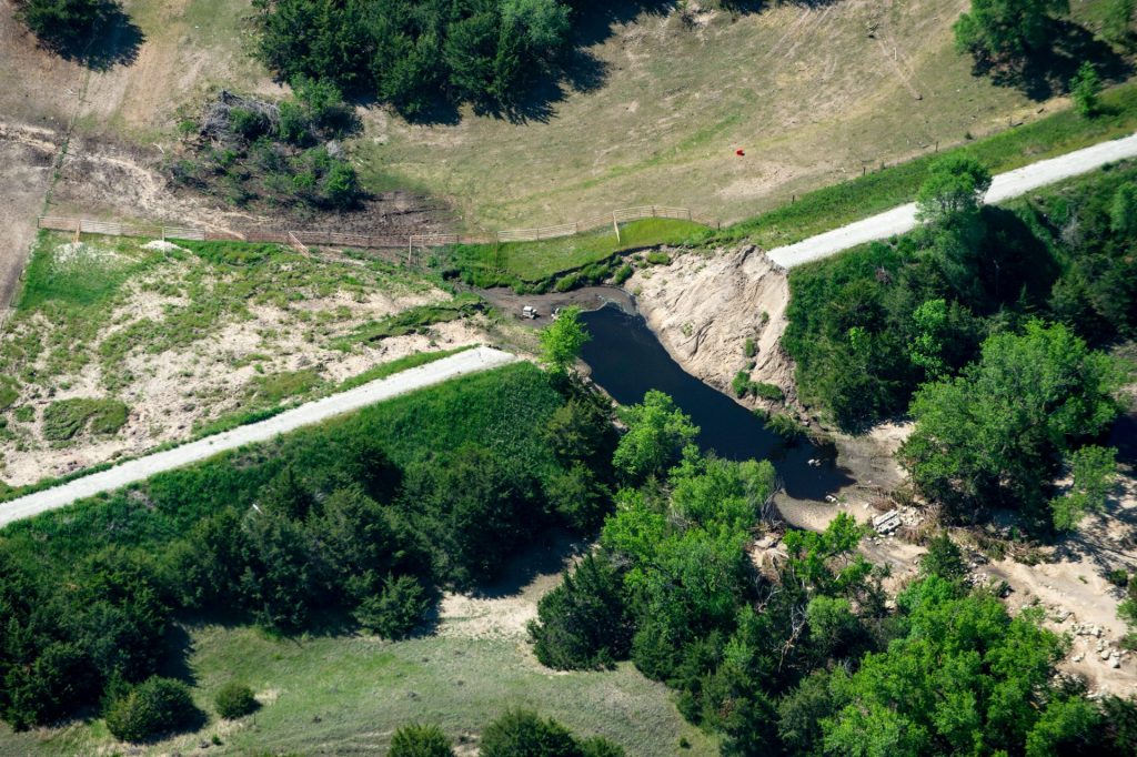
When the Platte River breached a levee separating it from a private sandpit lake west of Fremont, it sent floodwater flowing through that sandpit and washed out the embankment and road separating it from Lake 20 on the southwestern corner of Fremont Lakes SRA. Flows continued through Lake 20, washing out the bank separating it from Lake Leba, a private sandpit to the east.
That connection to the Platte allowed common carp, gizzard shad and other undesirable species of rough fish to enter the sandpit lakes. These species can disrupt an aquatic ecosystem by clouding the water or competing with game fish for food. Additionally, the flush of nutrients brought in by floodwaters can fuel algae blooms, another detriment to water quality.
Overland flooding carried rough fish into numerous public and private sandpit lakes along the Platte, Elkhorn, Loup and other rivers and streams in March, and again in July. Many of these lakes had undergone treatments to remove carp and had developed into excellent fisheries for largemouth bass, bluegills, crappies and other species. In many lakes, those treatments will have to be repeated to restore the fisheries. Once restocked, fish need at least three years to grow big enough to be coveted by anglers.
At Fremont, crews repairing the road along Lake 20 were forced to put culverts in to handle the water that continues to flow in from the Platte and through the lakes, putting work to restore the fishery in Lake 20 on hold.
Of the 20 lakes at Fremont, only two, Lakes 9 and 17, didn’t flood. It also appears that Lakes 1 through 8 on the park’s northwestern corner were spared from the reintroduction of carp. The rest of the lakes will eventually need to be renovated. Other work to improve water quality and fishing in recent years included the application of alum to tie up nutrients and control algae blooms. That work, which had been successful, may need to be repeated.
At Two Rivers SRA, all seven lakes flooded and now contain carp and other rough fish, including the Trout Lake. A renovation will be required there to maintain that popular put-and-take fishery. At Louisville SRA, all five lakes flooded but only Lakes 1 and 1A showed carp in sampling and will need to be renovated. Lake 2 may be treated to remove shad. Carp also found their way into waters at Memphis and North Loup SRAs and Ravenna Lake in March.
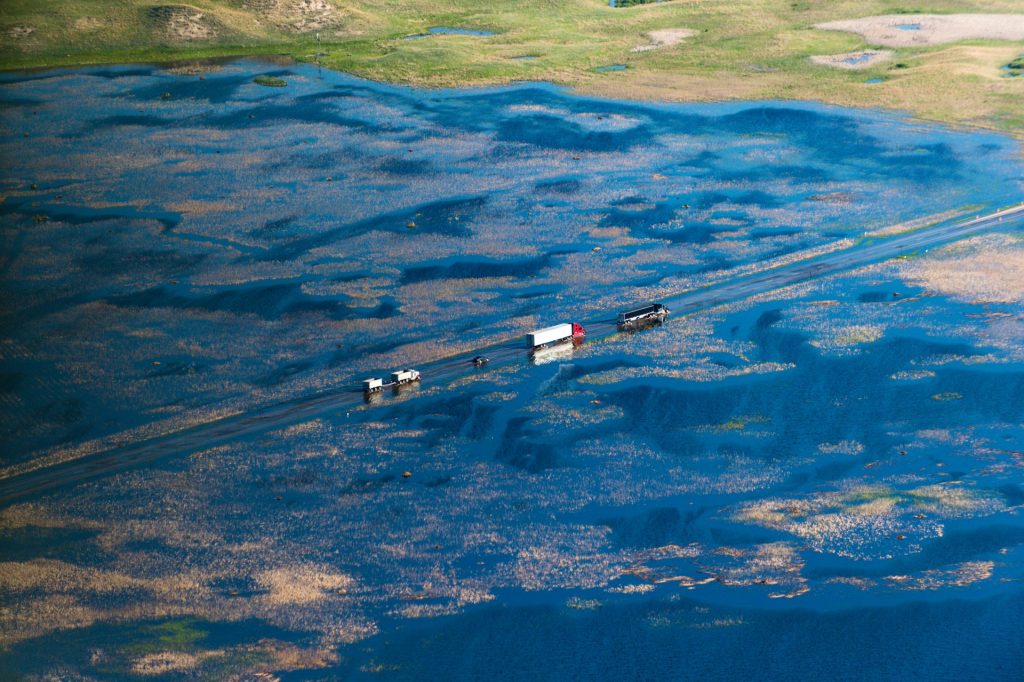
In early July, heavy rains in south-central Nebraska caused flooding on the Platte and Republican rivers and their tributaries. At Sandy Channel SRA near Elm Creek, floodwaters washed out the main road into the area, which also separated Lakes 4 and 8. The road was repaired and the park reopened in November. Dikes separating Lakes 1A and 2 from the south channel of the Platte were damaged. Carp invaded into four of the eight lakes on the area, including Lake 8, which had water quality high enough that it had become a popular site for scuba diving.
Near Kearney, flooding on Turkey Creek west of town brought carp and nutrients into sandpits at Yanney Park, Kearney Rest Stop, Kea West and Bufflehead WMAs, four Archway Lakes and numerous private lakes, all popular fisheries because of the quality and the proximity to the city.
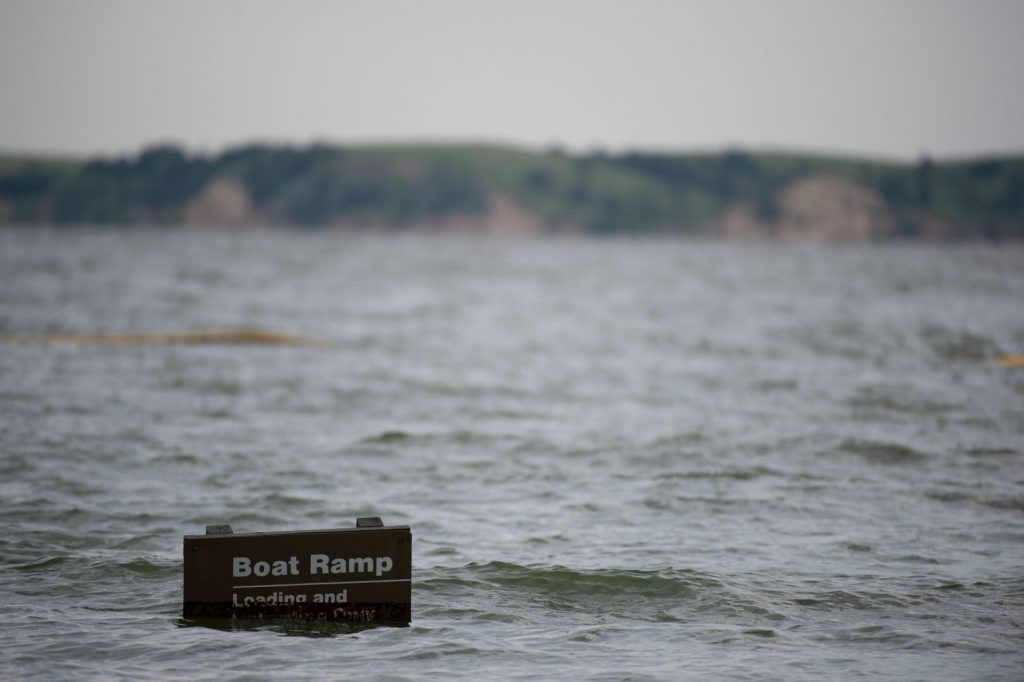
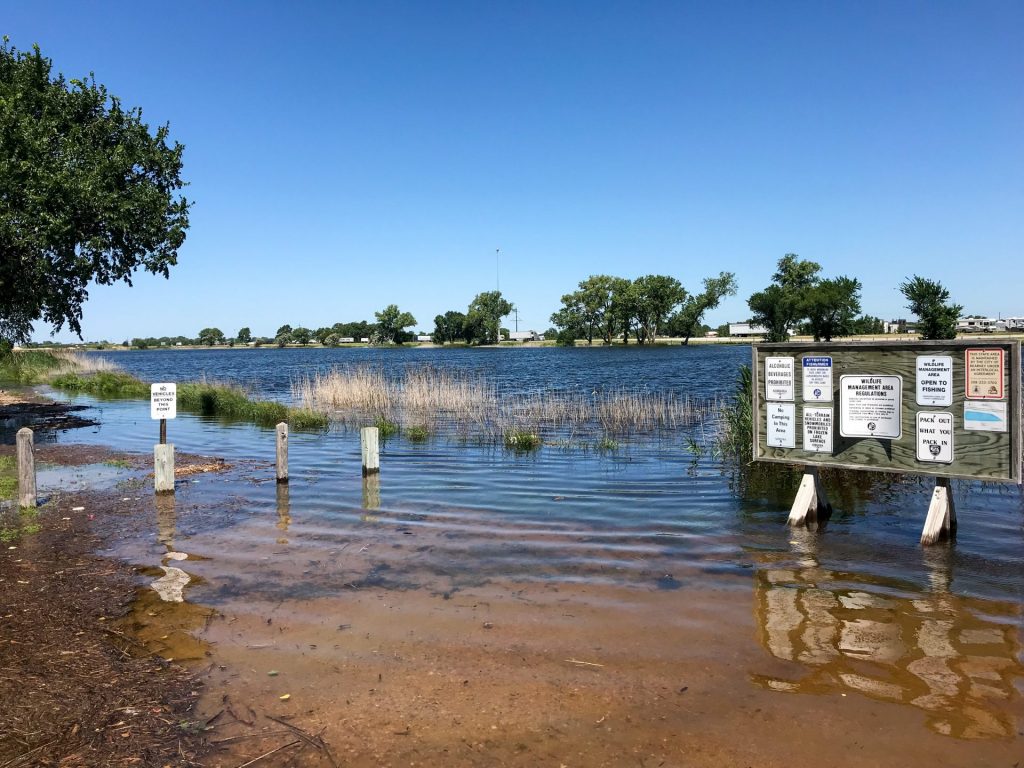
Harlan County Lake, a U.S. Army Corps of Engineers reservoir, rose 11 feet into its flood pool, inundating campgrounds, boat ramps and other facilities, limiting access to anglers for the rest of the summer.
In the Sandhills, precipitation that was well above normal for the year raised the level of groundwater and that of the numerous natural lakes in the region. The flooding closed highways and county roads, making access difficult to some of these popular fisheries. It also flooded the cabins and concession at Big Alkali WMA, forcing the area to close for the year. While the campground has reopened, it is not known when, or if, the cabins and concession will reopen. With water levels high, plans to renovate more lakes on the Valentine National Wildlife Refuge were delayed.
A fish bypass built by Game and Parks’ Aquatic Habitat Program at Spalding Dam on the Cedar River was not damaged, but the historic hydroelectric dam itself was breached in March. The Gracie Creek Trout Pond at Calamus Reservoir SRA will have to be dredged to sand that washed in during the flood.
The Valentine State Fish Hatchery and the Grove Trout Rearing Station were both damaged by flooding in March. At Valentine, dikes separating several ponds were washed out and others damaged, and several hatchery ponds were filled with silt. At Grove, a diversion dam on the East Branch of Verdigre Creek was damaged, roads washed out and ponds filled with silt. To renovate and restock lakes where rough fish were introduced will cost an estimated $1 million.
As for the fish in other rivers, streams and reservoirs, the effects of the flood are yet to be known. Creeks in north-central Nebraska, including Long Pine, Plum and Bone in Brown County, flooded, but most structures that had been installed to improve habitat for rainbow and brown trout were not damaged.
On the Missouri River, increased flows through Lewis and Clark Lake and five upstream reservoirs likely moved fish through that system just as it did in 2011. After that flood, paddlefish, pallid sturgeon and walleye stocked above the dam were found below it. Farther downstream, extensive flooding for much of the year led to increased production of blue and channel catfish, sickelfin chubs, blue suckers and other native fish that were able to spawn in inundated habitat on the floodplain. Fishing proved difficult to impossible for anglers, as river boat ramps were underwater throughout the year.
Wildlife
Flowing from the Sandhills and fed primarily by groundwater, the Loup River and its tributaries don’t flood as often as rivers and streams fed by surface runoff. But under conditions such as seen in 2019, they do. On March 14, Loup River hit a record level at Genoa, cresting at nearly 7 feet above flood stage, washing out Highway 39 south of the town.
About 2 miles downstream of the highway, where the river turns north at George Syas WMA, floodwaters moved overland to the east. On the inside of the bend, massive cottonwoods and other trees were toppled by ice and water. Standing trees now carry scars where ice gouged their bark 8 to 10 feet above the ground. Sand was deposited across the bend, measuring 4 feet deep in places and splaying out across roughly half of the area’s 700 acres.
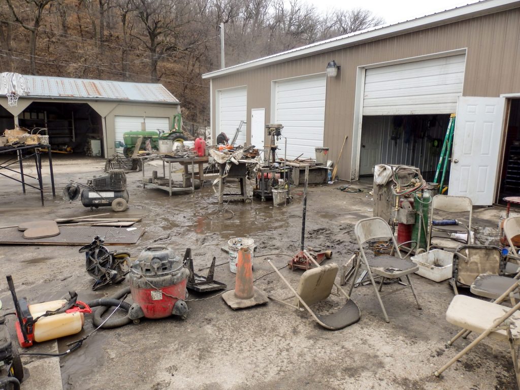
In the middle of the bend, Game and Parks staff, knowing a flood was coming, had moved equipment onto work benches in the maintenance shop, thinking it would be safe. During previous floods, water had reached depths of more than 2 feet in the shop and office. The new high-water mark is 44 inches above the floor. Flowing water undercut the base of a barn and damaged other outbuildings.
Floodwaters on the Loup continued downstream to the Platte. Near that river’s mouth at the Missouri River, floodwaters topped a levee on the south bank, flowed through two private sandpit lakes and then across Schilling WMA. For the rest of 2019, the Platte was carving a new course to the Missouri through the area. In January, that breach was closed, a move made to preserve the integrity of the Missouri’s navigation channel.
Schilling has flooded numerous times in recent years, most recently in 2011. Water had spilled into the office there three times, reaching a depth of 3 feet in 2011. In 2019, it was 7.5 feet deep. As was the case in 2011, water covered much of the area for most of the year, finally dropping below flood stage in November. Access roads on the area, including the main road leading from Plattsmouth 3 miles north to the mouth of the Platte, were washed out and massive amounts of sand were deposited on the area.
The same can be said for other wildlife areas popular among hunters and anglers on the Missouri, including Niobrara Confluence and Bazile Creek WMAs near Niobrara, and William Gilmour/Tobacco Island, Peru Bottoms and Langdon Bend, areas owned and managed by the U.S. Army Corps of Engineers in the southeastern corner of the state. A full assessment of the damage on those areas has yet to be completed, as most were inundated throughout the year.
Some access roads have yet to be repaired and cleared of fallen trees and debris on many wildlife areas that were affected, a fact that made access difficult for hunters this past season. Berms and water control structures on wetlands were damaged as well. The shops at Syas and Schilling remain closed and will likely be moved to areas that are not flood prone. The shop and outbuildings at Oak Valley WMA, which sits on Battle Creek and also suffered heavy flood damage in March, may also be moved to high ground. The total cost of all repairs is estimated at $2.5 million.
While wildlife was certainly displaced by flooding in 2019, populations are not believed to have been greatly affected. While some furbearers such as beavers and river otters may have perished when their dens were hit by ice, most birds and mammals are capable of moving to higher ground. The biggest losses may have been due to the harsh winter. In the western half of the state, a few mule deer deaths were documented following blizzards, and bobwhite quail didn’t fare well throughout the state. Wet conditions during May and June hampered nesting success for pheasants, quail and prairie grouse.

The flood and heavy precipitation appears to have helped some species, however. Threatened least terns benefitted from the increase in sandbars created on the Niobrara, Loup and Platte rivers. In the Sandhills, nesting success for ducks and geese was the highest it’s been in at least 10 years thanks to ample wetlands. Duck production was as high as it has been for decades in Rainwater Basin wetlands, where American avocets and cattle egrets were found to have nested for the first time on record.
The changes to the landscape on some areas may benefit some wildlife species in the years to come by creating a maze of early successional habitat. On riverine areas where sand and silt was deposited, a flush of sunflowers and other annual plants will flourish. Willows and cottonwoods will colonize sandbars and other areas where deposited. On meandering rivers like the Elkhorn, Cedar and Calamus, new oxbow lakes and wetlands were created where the river cut across a bend and made a new course. ■
Doing Their Job
The flooding that occurred last March in Nebraska was expected. The scale, however, was not. And as rivers crept out of their banks and topped and carved holes in levees, many people who assumed they would be safe found themselves stranded in their homes, some at risk of being swept away.
Game and Parks Commission staff, including conservation officers and fisheries and wildlife biologists, did what Nebraskans often do in situations such as this: they jumped in to help.
Using a variety of boats, staff braved rising waters, strong currents and high winds, dodging debris, fences and other submerged obstacles, to rescue 148 people, young and old, during the peak of the flooding, pulling some from rooftops and second-story windows. Numerous pets were given rides to safety with their owners. Staff helped evacuate several housing developments along the Platte, Elkhorn and Big Blue rivers.
Not counted in the above number were the residents moved from a nursing home in Wood River surrounded by floodwaters, and reuniting parents with children who were stranded overnight in a daycare in Fremont. In western Nebraska, officers helped rescue 20 stranded motorists on highways during the blizzard.

Work went beyond rescues. Staff helped evacuate some housing developments and fill sandbags ahead of advancing floodwaters, delivered medicine to those who needed it, ferried people to hospitals for dialysis appointments and to visit a cancer-stricken patient and more. In the days after, they used kayaks and airboats to rescue pets that were stranded when homes in Bellevue flooded while their owners were at work.
Levi Krause, a conservation officer from Louisville, spent four days using his air boat to help other first responders rescue 60 people and their pets, earning him an Award of Valor from the agency’s Board of Commissioners and the Law Enforcement Commendation Medal from the Nebraska Society of the Sons of the American Revolution. Conservation officers shared the Lifesaving Valor Award from the Mead Fire and Rescue Department. All Game and Parks staff members who assisted in flooding efforts were recognized for going above and beyond the call of duty to keep people safe. Krause and others involved say they were simply doing their job, just like so many other first responders.
Historic Flooding
Record snowfall was recorded at many locations across Nebraska in early 2019. Cold temperatures in February kept most of that snow from melting, pushed the frost line deep into the ground and formed a heavy layer of ice on rivers. Then Winter Storm Ulmer arrived on March 13. The bomb cyclone brought blizzard conditions to western Nebraska, and warm temperatures and 3 inches of rain in eastern Nebraska. With the ground frozen, the rain and rapidly melting snow ran off into rivers and streams, sending a rush of water and ice downriver. Thirty stream gauges, including those on the Loup, North Loup, Wood, Niobrara, Platte, and Elkhorn rivers and several creeks, reached all-time record highs.

Total precipitation for 2019 was well above normal across most of Nebraska, and other Northern Plains states, with record levels recorded in some locations. That kept most rivers, including those fed by groundwater in the Sandhills, at levels well above normal throughout the year.
Runoff in the Missouri River basin above Sioux City nearly matched the record set in 2011, forcing the Corps of Engineers to release nearly more water than normal from Gavins Point Dam. These releases combined with high flows from other tributaries below the dam kept the river above flood stage in some locations for most of the year.
River levels remain above normal across Nebraska, raising the possibility of more flooding in 2020.
The post 2019 Flood: $19 million in Damage appeared first on Nebraskaland Magazine.


